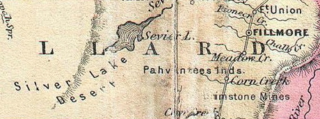
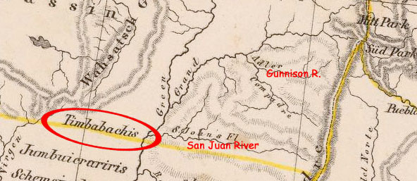
When I was in the process of researching the route of the group of adventurers, led by Old Firehand, Old Shatterhand, and Winnetou, with Aunty Droll, Hobble-Frank, Long Davy and Fat Jemmy, Black Tom, Engineer Butler and his daughter Ellen, Fred Engel, as well as Missouri-Blenter among them, Karl May friend Philip and I kept stumbling upon the similarities between their route, and the one taken in 1853 by Captain Gunnison and a group of engineers, by order of the Government of the day, to find a suitable passage for the railroad construction to connect the east coast of the United States with the west coast.
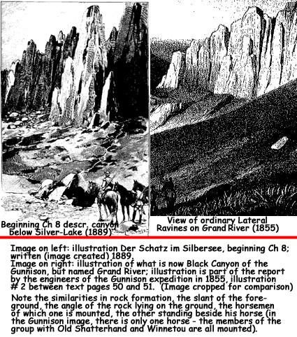
The similarities of certain text passages were undeniable (see The Treasure In Silver-Lake); and when I perused the reprint of the early 1891, serialized version of the novel, courtesy of the Karl-May-Gesellschaft website, I was struck by the similarities of these two particular images.
The one on the left is the depiction of the canyon below Silver-Lake, (by artist Ewald Thiel), the description of which was inspired by Moellhausen's own published diaries of the exploration of the lower Colorado, written during the expedition under Lieutenant Joseph Christmas Ives in 1857, with a number of beautiful, historic sketches.
The drawing on the right is a cropped image of a drawing created by the artist on the expedition of 1853 under Captain John Williams Gunnison; it depicts a section of the Black Canyon of the Gunnison in the report of 1855. Gunnison Report illustration.